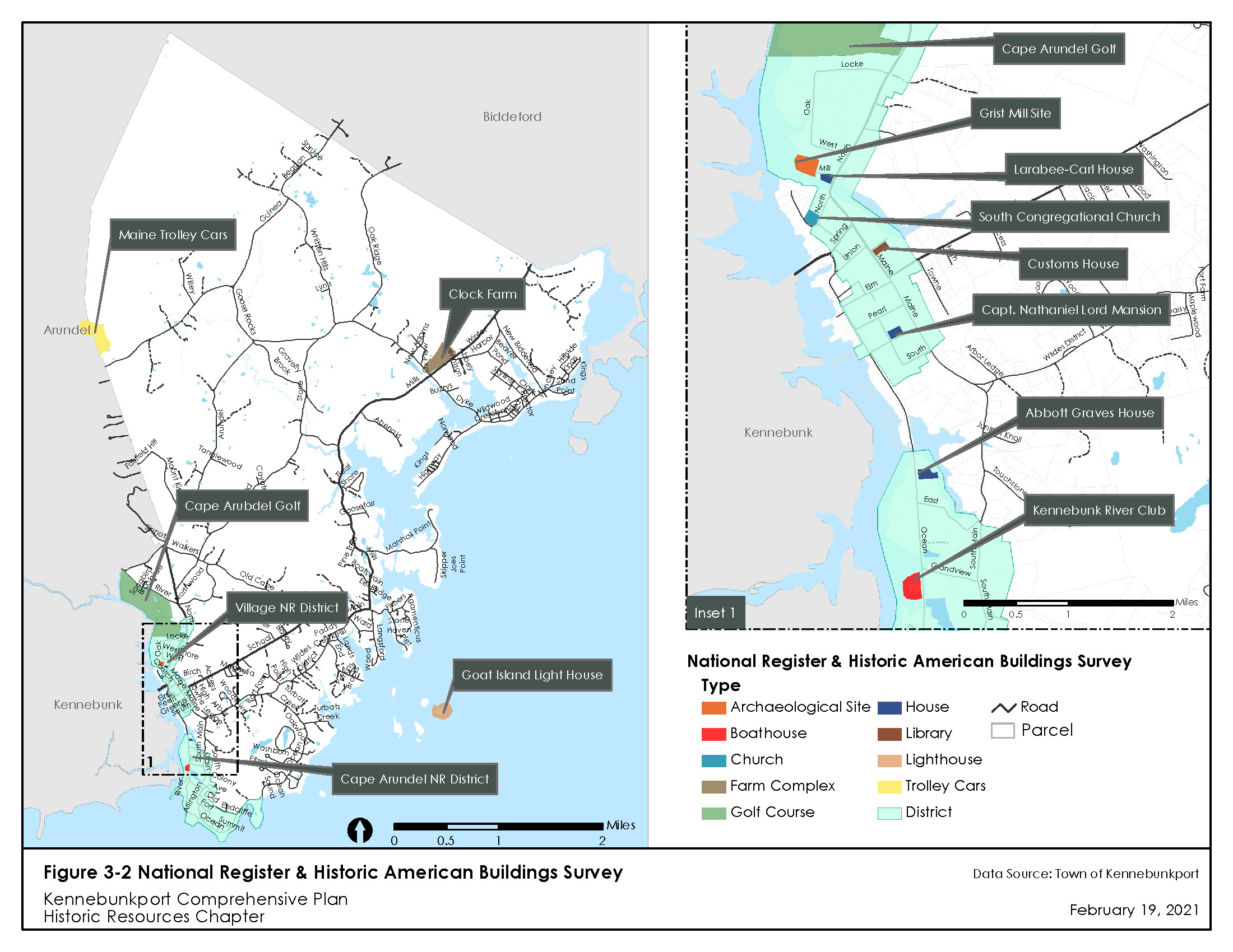
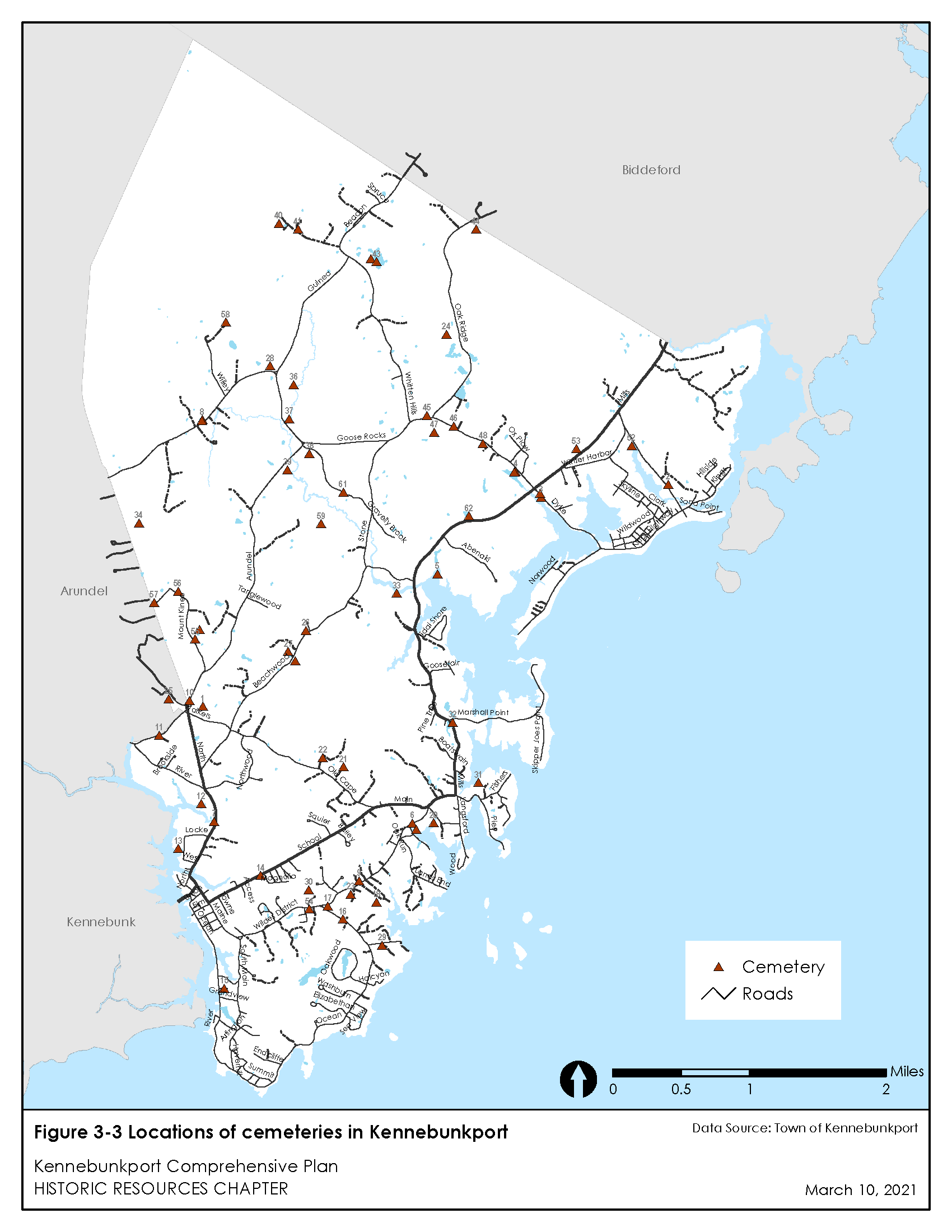
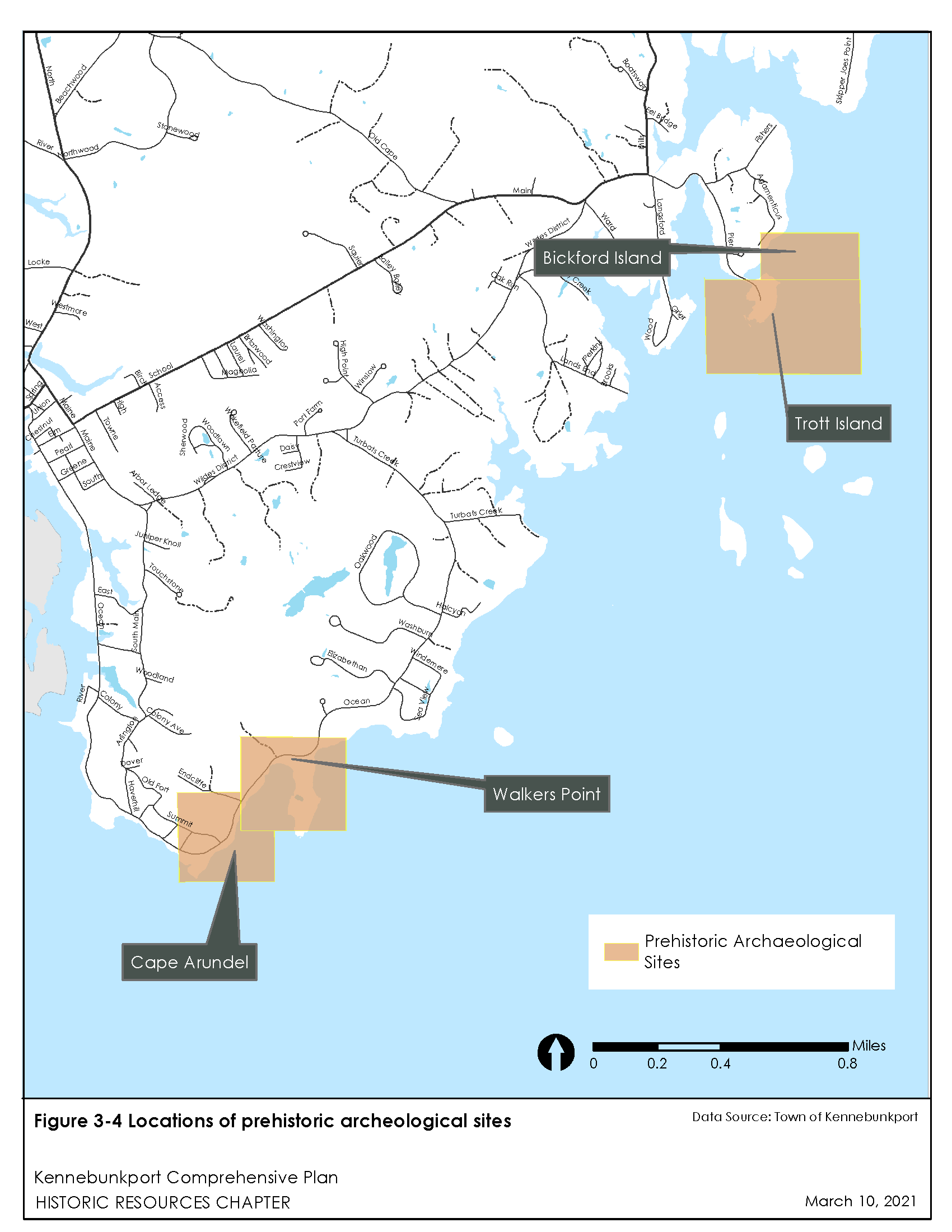
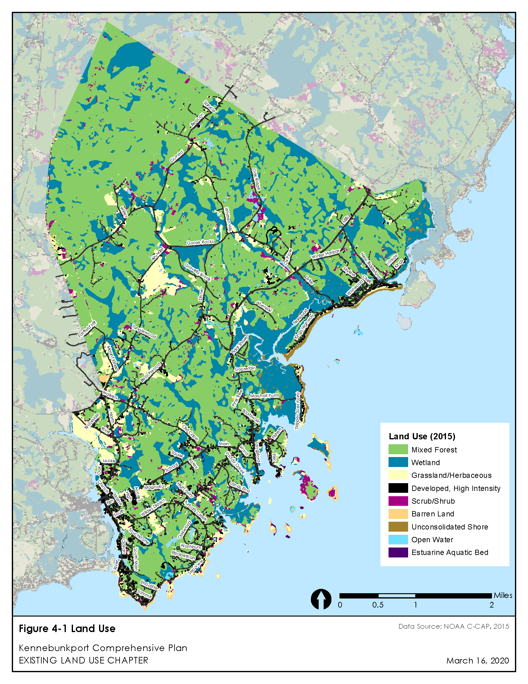
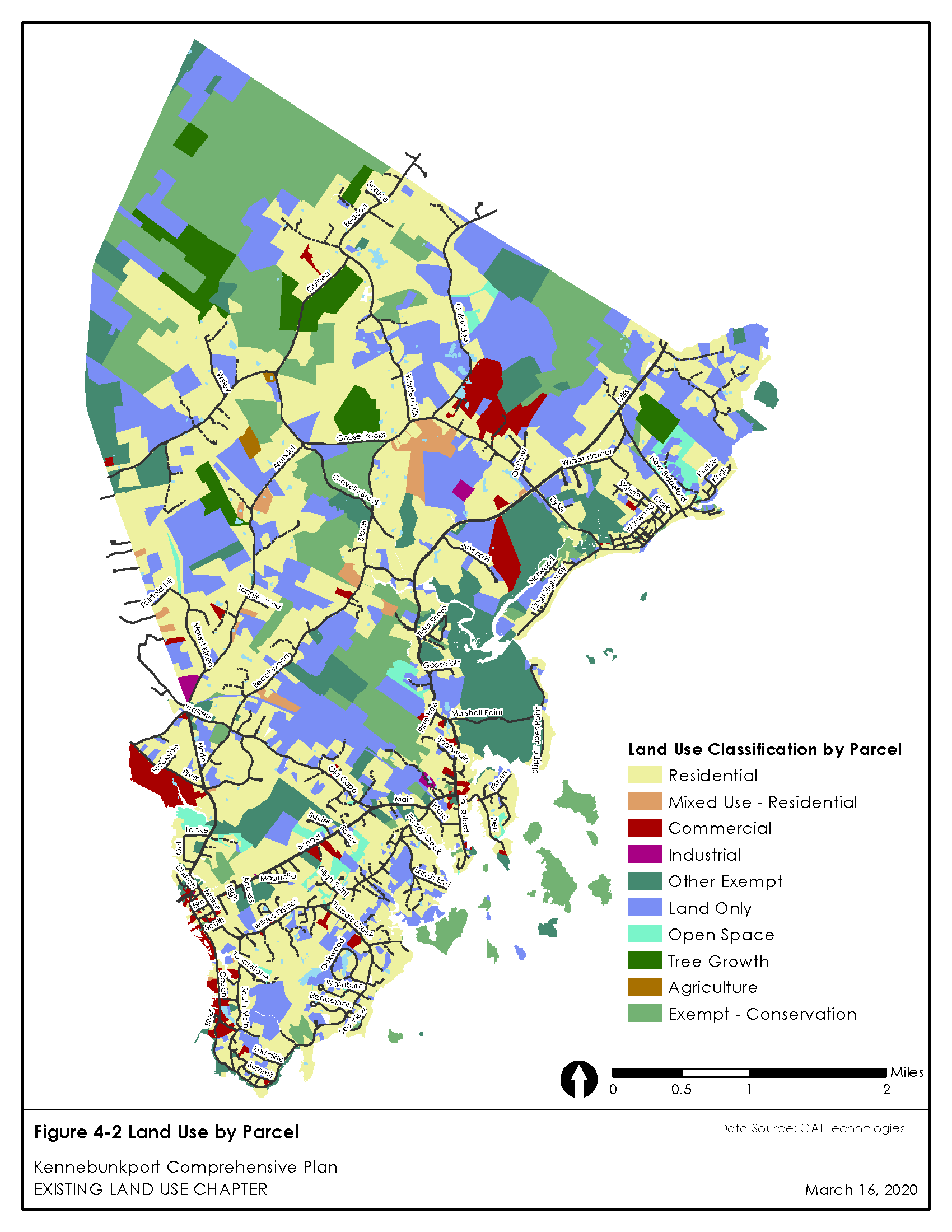
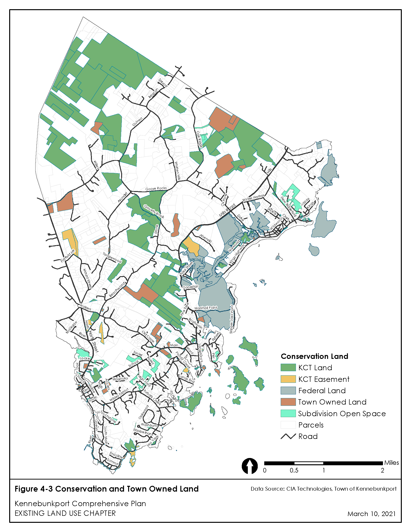
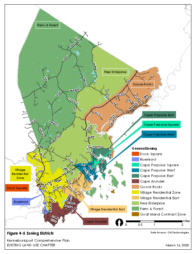
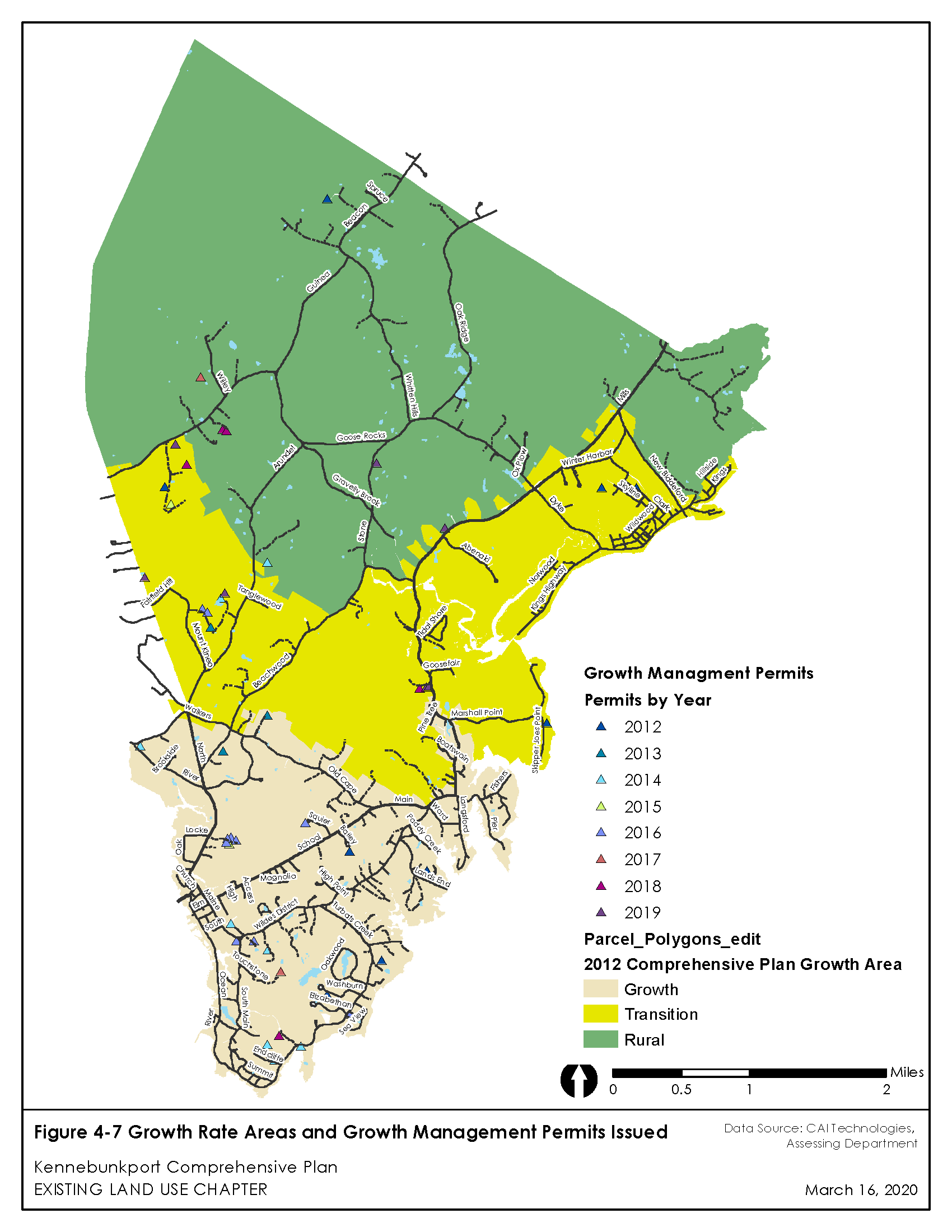
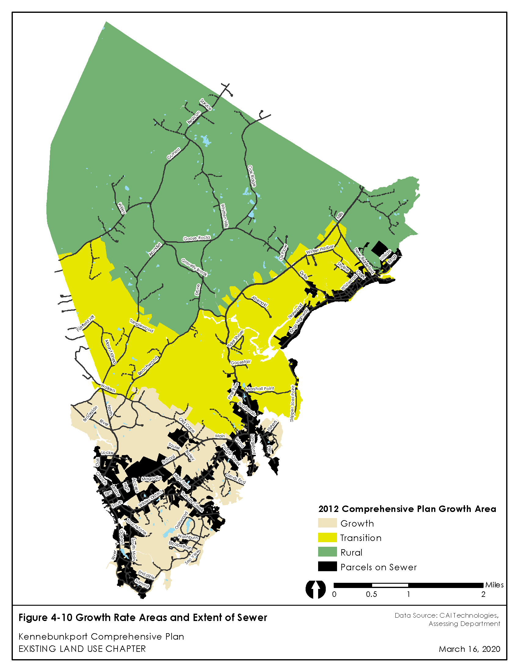
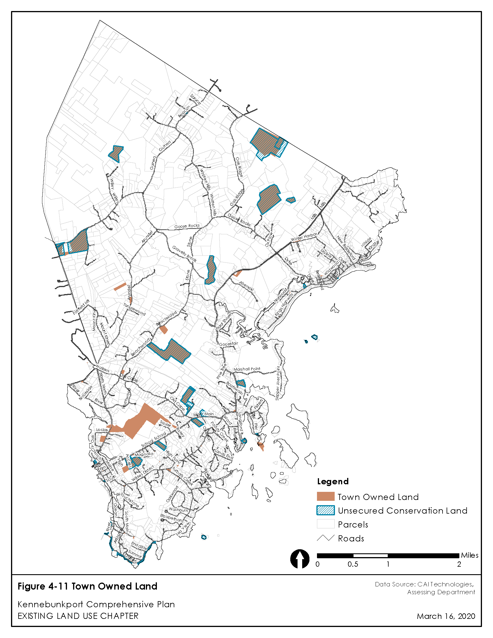
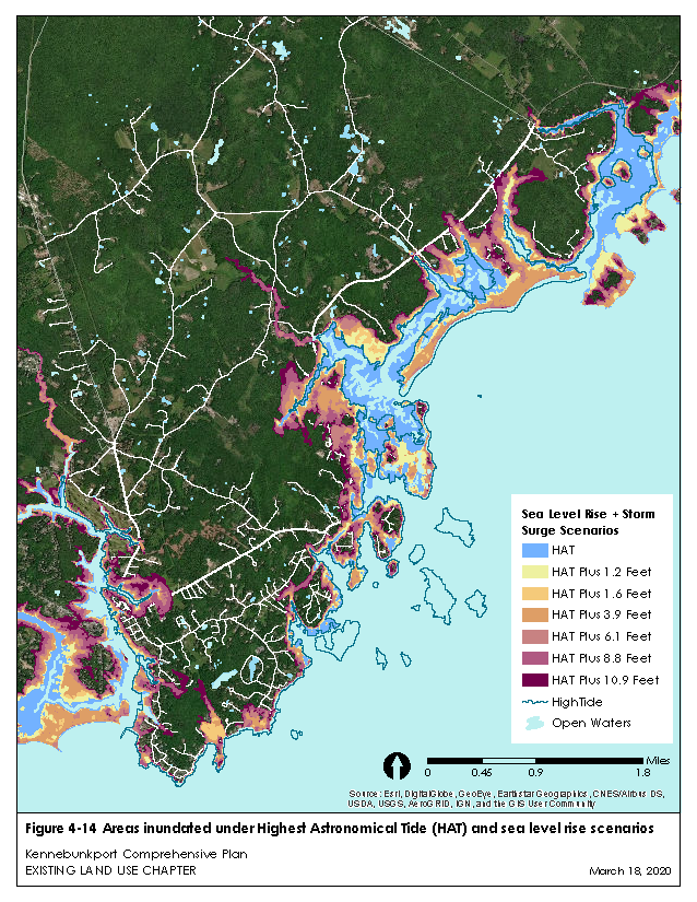
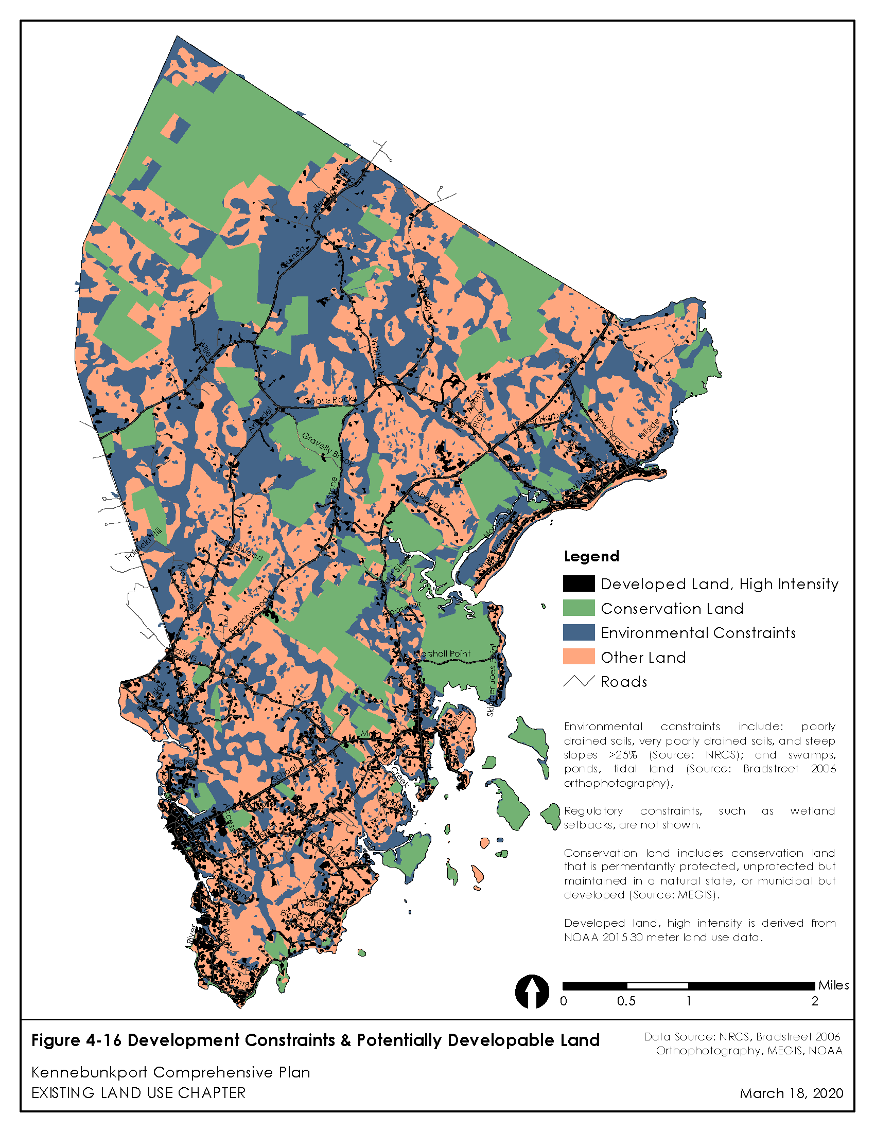
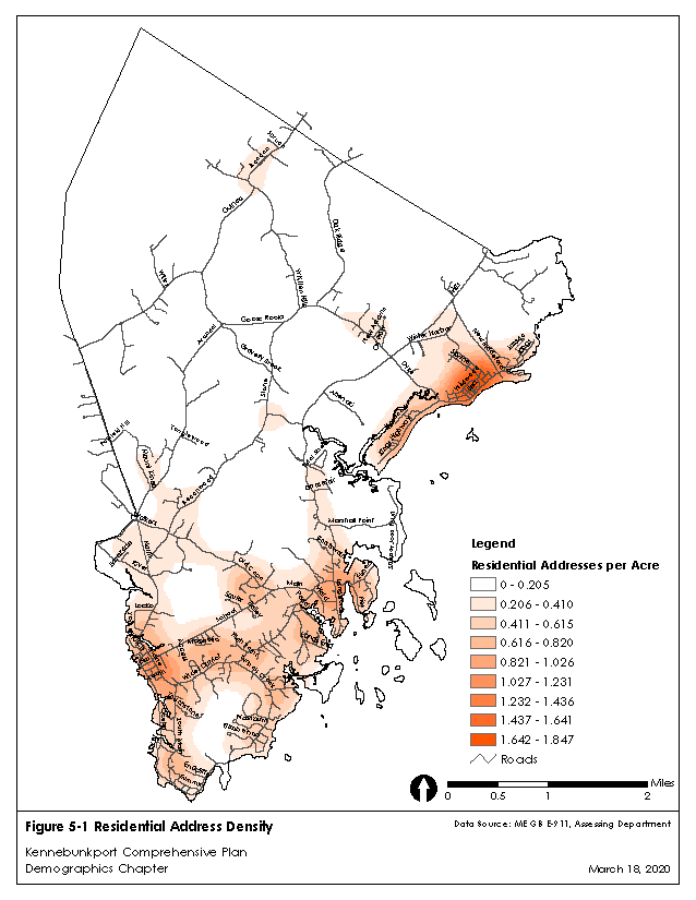
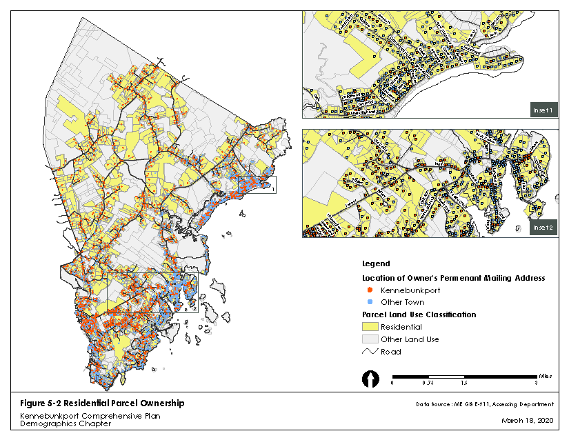
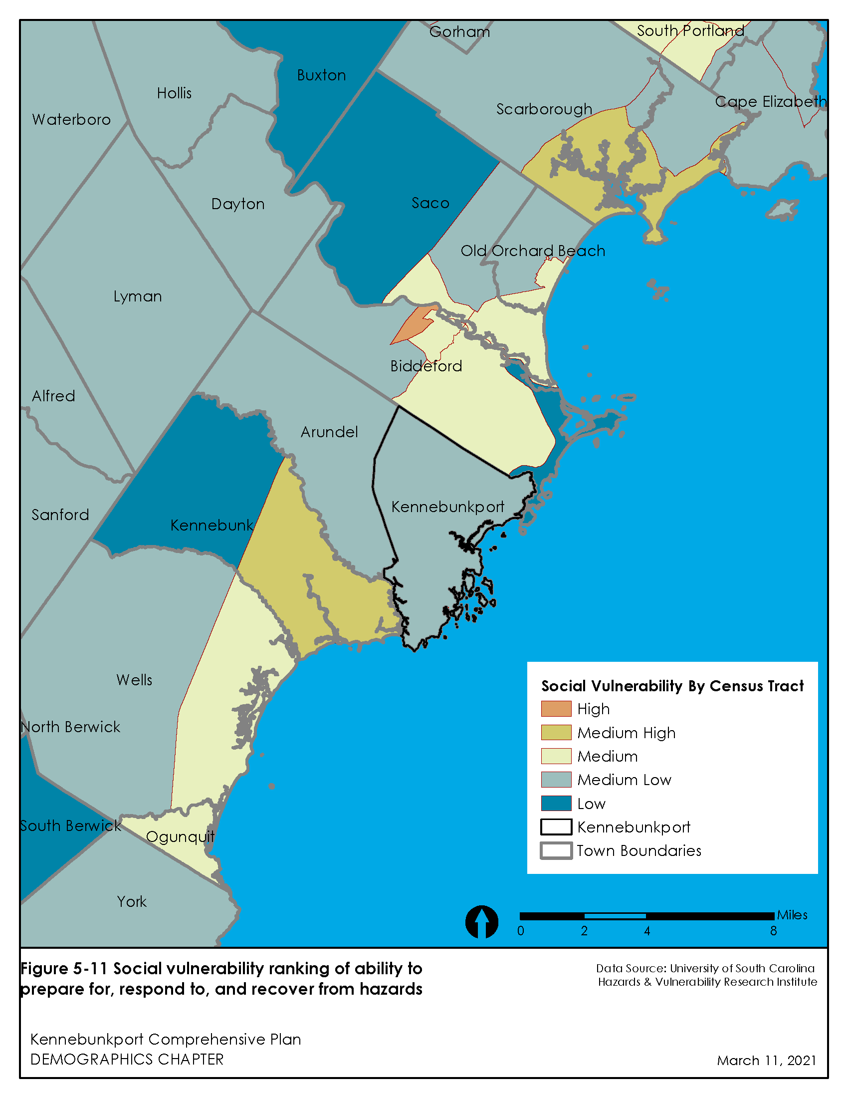
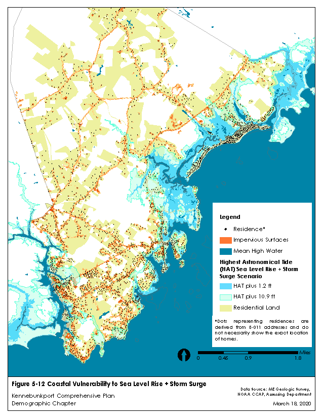
See below maps of properties listed on the National Register of Historic Places, cemeteries, archaeological sites, land use, land use by parcel, conservation land, zoning districts, growth rate areas, growth rate areas with sewer, Town-owned land, sea level rise and storm surge scenarios, development constraints, residential address density, residential parcel ownership, social vulnerability, and coastal vulnerability to sea level rise & storm surge. Click the map images in order to access a larger version of the map.