Most maps listed below were produced between 2019 and 2021. Toward the bottom of the page is a group that was produced between 2008 & 2012.
Natural Resources (Chapter 7)
USGS Topographical
Drainage Divides
Surficial Geology & Aquifers
Soils
Habitat and Endangered, Threatened, and Species of Concern
Habitat – State Wildlife Action Plan
Beginning With Habitat Focus Areas and Conservation Land
High Value Plant & Animal Habitat
High Value Bird Habitat
Undeveloped Habitat Blocks & Connections
Undeveloped Habitat Blocks & Connections v.2
Aquatic and Riparian Habitat of Water Resources and Their Associated Buffers
High Value Bird Habitat
Co-occurrence Map
Water Resources (Chapter 8)
Water Resources
Drinking Water Resources
Floodplain
Transportation (Chapter 11)
Transportation Features
Road Safety Rating
Parking
Bridges & Culverts with Ratings
Pedestrian Ways
Connectivity
Waterfront Access
Traffic Count & Volumes 2016
Crashes 2014
Sea Level Rise and Road Inundation
Recreational & Cultural Resources (Chapter 15)
Hazard Mitigation (Chapter 16)
Critical Facilities and Evacuation Routes
Coastal Flood Hazards
Coastal Erosion Hazard Areas
Sea Level Rise and Storm Surge Scenarios
Sea Level Rise and Storm Surge Scenarios v2
Coastal Vulnerability
Areas Inundated Under Highest Astronomical Tide (HAT) and Sea Level Rise Scenarios
Coastal Vulnerability to Sea Level Rise & Storm Surge
Social Vulnerability
Social Vulnerability by Census Tract
Land Use
Conservation & Town Owned Land
Land Use by Parcel
Land Use in 2015
Residential Address Density
Residential Parcel Ownership
Town Owned Land
Zoning Districts
Growth
Development Constraints & Potentially Developable Land
Growth Rate Areas and Growth Management Permits Issued
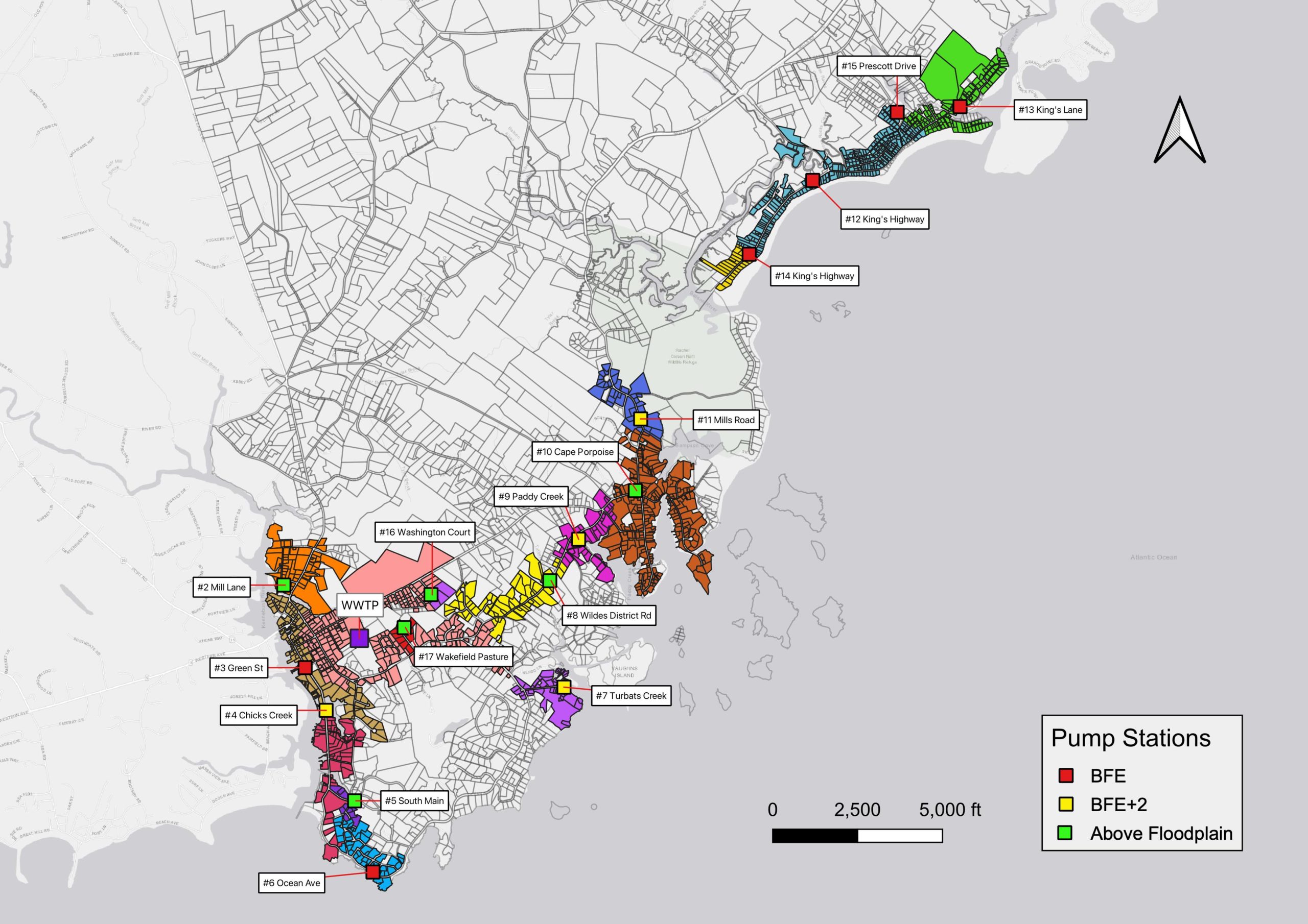
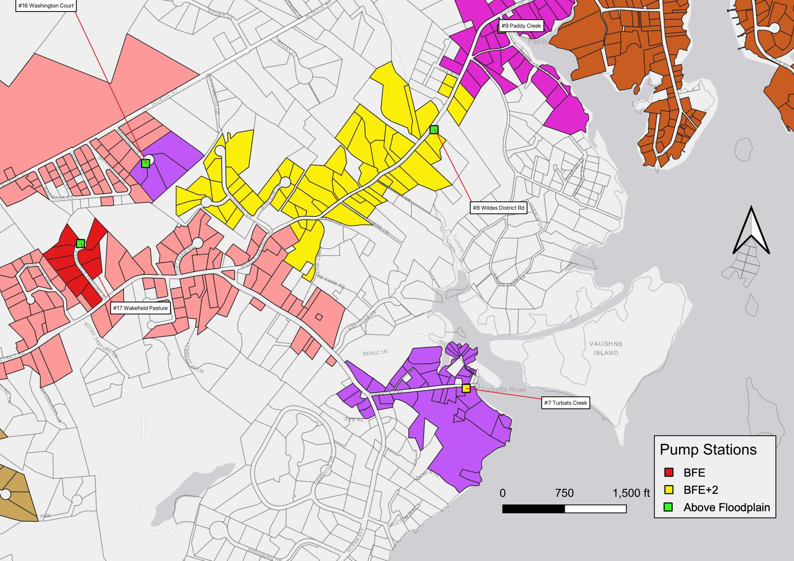
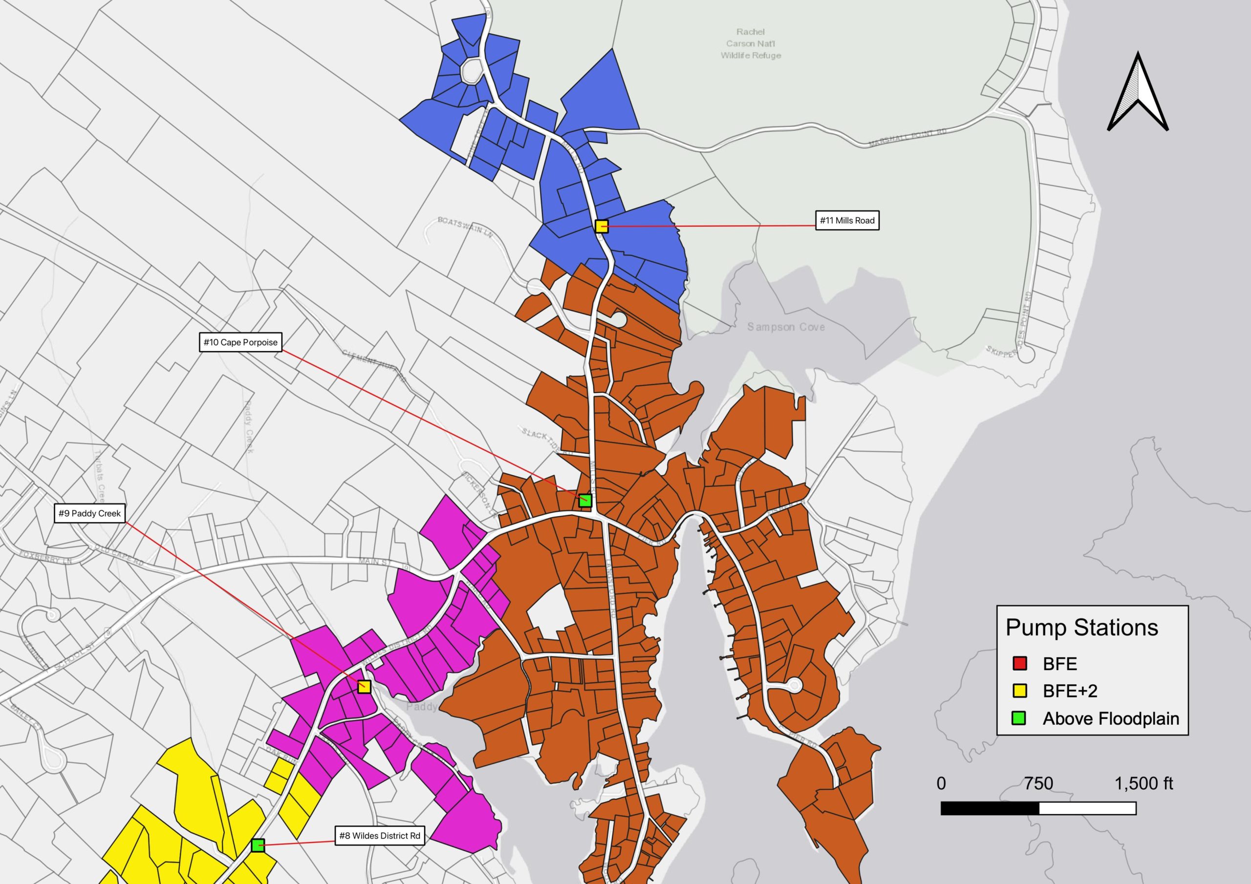
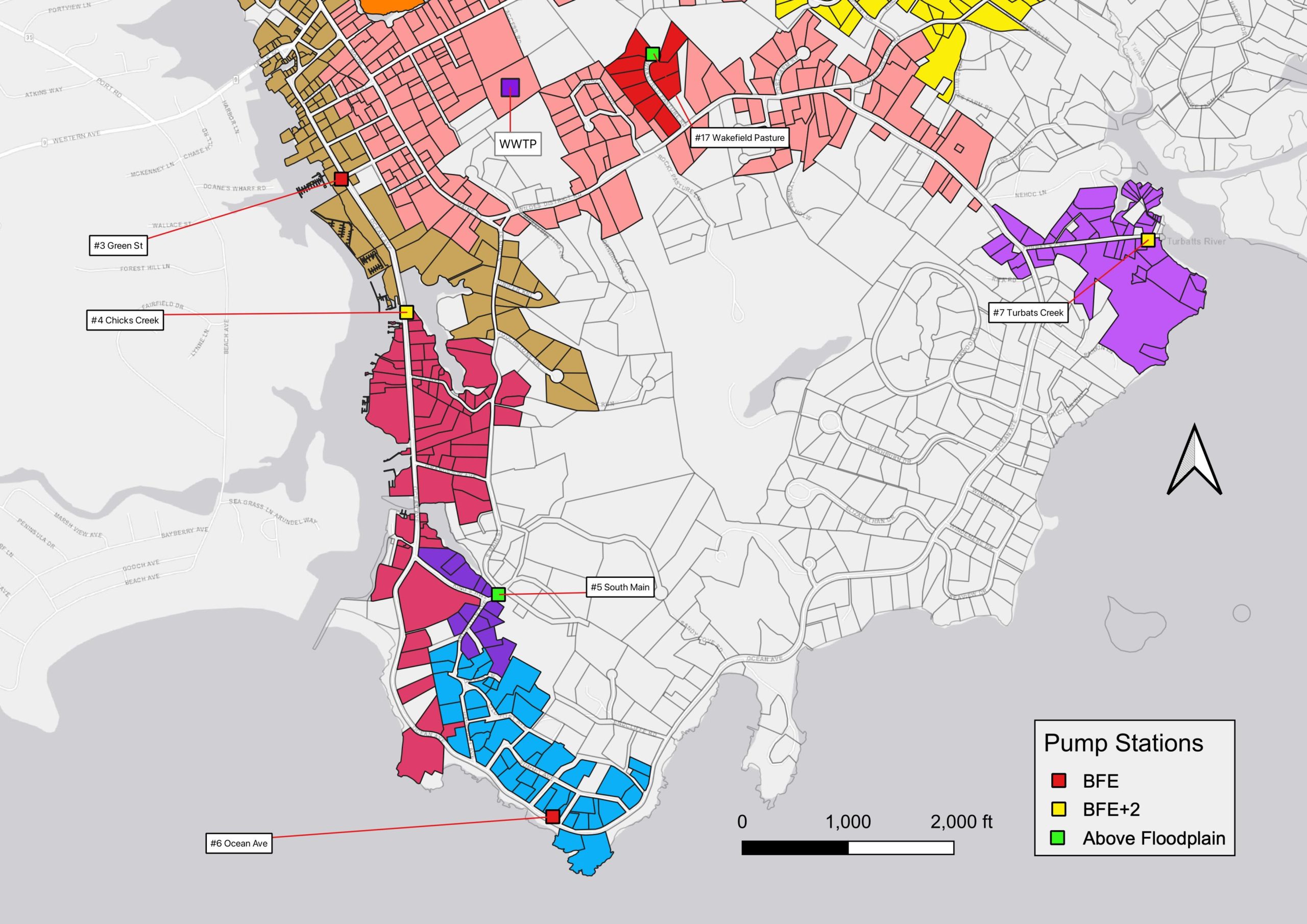
Sewer System
Growth Rate Areas and Extent of Sewer
Sewersheds Townwide
Sewershed Goose Rocks
Sewershed Wildes District
Sewershed Dock Square
Sewershed Cape Porpoise
Sewershed Cape Arundel
Historic Resources
Cemeteries
National Register & Historic American Buildings Survey (HABS)
Prehistoric Archeological Sites
Maps Produced Between 2008 & 2012
Aquifers
Building Permits
Buildings Over time 1990
Buildings Over Time Pie Charts
Developable Land
Developable Land version 2
Build Out Analysis
Drainage Divides
Floodplain
Growth Area 2010
Growth Areas Revised
Gulf of Maine
Impervious Surfaces
Maine Natural Areas
Not Available for Development
Physical Constraints
Rare Plant & Animal Habitats
Road Classification
Road Map with Water Features
Wetlands
Wetland Soils
Zoning Map with Shoreland Zoning
Zoning